Avoca Catchment
Mountains, valleys, woods and rushing rivers represent the Avoca catchment in the popular imagination, perhaps best expressed in Tom Moore’s “Meeting of the Waters” in the Vale of Avoca:
“There is not in this wide world a valley so sweet
As that vale in whose bosom the bright waters meet
Oh the last rays of feeling and life must depart
Ere the bloom of that valley shall fade from my heart”
Junction of the Avonmore and Glenmacnass Rivers
Photo courtesy of Tom Harrington
The Avoca and its tributaries are a river system that has only one exit to the sea and drains a defined area of land known as its catchment or watershed.
With an area of 670 sq. km, the Avoca catchment is the largest river system in County Wicklow, draining most of the eastern area of the Wicklow Mountains. It is also one of the most spectacular and natural river systems in the whole country, despite paradoxically being subjected to pressures in the past that still exist, with some additional modern pressures.
The headwater stream that is furthest from the sea (42 km as the crow flies) is the Cloghoge River, which rises on the south slopes of Tonduff Mountain, to the south of the Sally Gap, flowing through Lough Tay and then Lough Dan, which also receives the Inchavore River draining the heavily forested Inchavore valley.
The waters then continue south from Lough Dan as the Avonmore River. At Laragh the Avonmore is joined by the Glenmacnass River which drains Lough Ouler, and by the Glendasan and Glenealo Rivers which drain Lough Nahanagan and the Glendalough Lakes. The Turlough Hill pumped storage hydroelectric generating station is situated on the headwaters of the Glendasan River.
The Avonmore continues south through through a wooded valley to Rathdrum and Avondale Forest Park and then to its confluence at the Meeting of the Waters where the Avonbeg River joins. Now called the Avoca River, it continues past its namesake town of Avoca to Woodenbridge, where the Aughrim River flows in. This tributary is the combined outflow from the Ow River and Derry Water.
Downstream of Woodenbridge, the Avoca River flows through a flat-floored, steeply-sided valley before becoming tidal just upstream of Arklow Town, through which it flows before it makes it way to the sea via Arklow Harbour.
The total channel length of the Avoca and its three main tributaries is approximately 679 km. There is a significant rainfall gradient from west to east across the Avoca catchment; annual rainfall ranges from greater than 2,000 mm per year in the mountains to only half that on the coast. The rivers for the most part are rocky, fast-flowing ‘spate’ rivers that can rise and fall very quickly with rainfall.
Unlike so many other Irish rivers that have been radically altered by arterial drainage, the rivers that make up the Avoca system retain their original and often turbulent courses, and in many places, their natural riverside woodland habitats.
Old native broadleaf woodland is more abundant here than anywhere else in Ireland, and the catchment contains a mixture of lowland, upland and mountain habitats that is the most diverse in the country. Their importance to the conservation of biodiversity in Ireland was recognised by their inclusion within the boundaries of Wicklow Mountains National Park (WMNP), established in 1991.
The woodlands, uplands and mountains and valleys of the catchment have long attracted walkers and outdoor enthusiasts. The Wicklow Way, first proposed by hill-walking enthusiast JB Malone in 1966, was the first way-marked trail to be developed in Ireland and crosses much of the upland Avoca catchment. Monastic heritage sites and mining heritage sites in the valleys also attract large numbers of visitors.
Lough Dan and Lough Tay Inland Fisheries Reports
Lough Dan
Lough Tay
Avoca Estuary
Take a closer look at the Avoca catchment

Aquatic Invertebrates in the Avoca–Avonmore Catchment
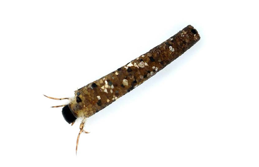
Discover the diverse aquatic invertebrates in the Avoca–Avonmore catchment — insects, crustaceans, snails, worms and more that form the foundation of freshwater food webs. Learn how species like mayflies, stoneflies and caddisflies signal water quality, support fish and reflect the ecological health of rivers and lakes across the catchment.

Fish in the Avoca–Avonmore Catchment
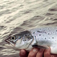
Explore the variety of fish species in the Avoca–Avonmore catchment — from brown trout, eel and lamprey in freshwater to migratory sea trout. Learn how river conditions, food availability and historic pressures like mining have shaped fish populations, and why restoring habitat and passage could help support salmon and other native species.

Rivers and Lakes in the Avoca–Avonmore Catchment
Learn about the rivers and lakes that shape the Avoca–Avonmore catchment — from upland, nutrient‑poor oligotrophic lakes like Lough Dan and Lough Tay to rivers flowing through rocky valleys. Understand how geology influences water chemistry and ecology, and why these interconnected waterbodies are important for biodiversity and landscape character.

Biodiversity in the Avoca–Avonmore Catchment
Explore the rich biodiversity of the Avoca–Avonmore catchment across upland heaths, oak woodlands, wetlands and river valleys. Learn how protected sites like SACs and SPAs conserve habitats and wildlife including otters, birds and aquatic species, and how community and conservation actions contribute to resilient ecosystems across this diverse landscape.

Avoca River
Discover the Avoca River, formed at the Meeting of the Waters where the Avonmore and Avonbeg join and flowing to the Irish Sea at Arklow. Learn about its natural beauty, historic challenges from mining pollution, and the ecological importance of its headwaters and tributaries. The Avoca’s waters sustain habitats and communities across East Wicklow’s largest catchment.

Avonmore River
Explore the Avonmore River, rising from Lough Dan in the Wicklow Mountains and flowing through wooded valleys before joining the Avonbeg at the Meeting of the Waters to form the Avoca. Discover its scenic route past Rathdrum and Avondale, its role in the catchment’s hydrology, and its importance for river habitats and local wildlife.

Avonbeg River
Learn about the Avonbeg River, a key tributary of the Avoca system rising in the Wicklow Mountains and flowing through Glenmalure before meeting the Avonmore at the Meeting of the Waters. Discover its ecological character, contribution to the catchment’s flow regime, and role in supporting freshwater habitats and native fish populations.

Cloghoge River
Explore the Cloghoge River, the most distant headwater of the Avoca catchment rising near the Sally Gap. Flowing from mountain slopes into Lough Tay and Lough Dan, it drains upland terrain shaped by granite and schist and contributes to the Avonmore system. This tributary supports upland river habitats and connects high mountain landscapes to catchment waters.

The Avoca Mines
Discover the history and environmental impact of the Avoca Mines, once a major copper and sulphur mining area in Wicklow. Learn how historic mining altered landscapes, created spoil heaps, and continues to influence river water quality through acid mine drainage, affecting aquatic life. Explore how ongoing monitoring and remediation efforts aim to improve conditions in the Avoca River.
